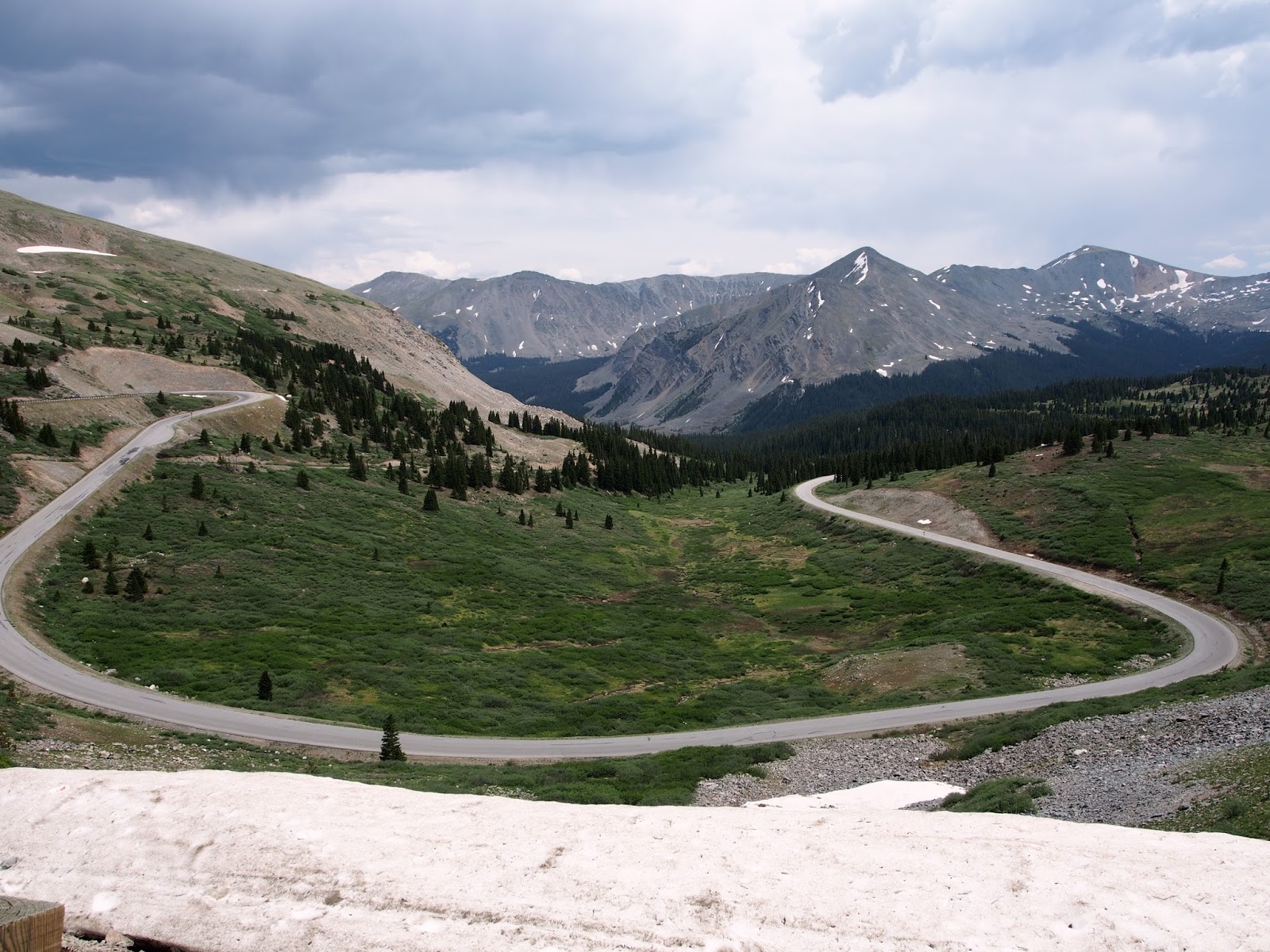
If you've been wondering where we were for the last four days, it was here. Between these elevation lines.
 |
| Cuba is at the bottom right at 6900 feet elevation, and the top black line is 10,000 feet elevation. The profile goes right to left going northbound, so up we went from Cuba. |
That's right, we are going northbound, right to left on the map here, and rode, walked or pushed every portion of the above profiles.
CUBA
The climb out of Cuba is pavement, but is a solid 2500 foot elevation climb. I didn't want to push myself too much, so I decided to gain the elevation and get to a beautiful camp site. We made it by 4:00 pm and had plenty of time to scout for a site. Randy and some other hikers from Tucson were camped in the spot that I had been looking at, and they welcomed Neva and I into to the group as part of their small camping community.
Neva and I even had a chance to take a short mile hike to San Gregorio Reservoir and admire the wild flowers that were in bloom
I thought Neva might want to trade in the bike for hiking.
She was spouting a tutorial every ten minutes on how to hike, what
things are 'pokey' and what animals can 'make you dead' while wielding
her trusty, knotted hiking stick like she's a character out of Lord of
the Rings.
We slowly started climbing, up and up to beautiful views. The road was a nice packed down gravel and nice to ride.
We climbed up to an aspen grove.
Seeing all of the aspens, you can't help but think of famous artist renditions of the groves. Picasso, Klimt, etc. The white bark is so bright in contrast with the green leaves in the spring, and golden leaves in the fall, they're wonderfully meditative to bike through.
Neva and I camped out at the base of the most difficult part of the route. We did our best to hang our 30+ pounds of food out of potential hungry bear reach, but I think we just successfully put our food out of our own reach. We wouldn't have to worry about the Red Dawn guerrilla forest children running off with our food, at least not that night.
The road really deteriorates to a 4WD road that, as were apparent by the lack of car tracks, not many vehicles would be willing to brave.
 |
| Neva and turtle posed while I took a break. |
I had to push a good portion, or have Neva walk while I biked very slowly up the rocky terrain.
The photos don't quite do the steepness or difficulty justice, but the Chariot, Neva and I made it to the other side... after about 5 hours and 5 miles later, we cleared that beast. We were welcomed by a delicious oasis of fresh water.
Okay, beauty is in the eye of the beholder, I guess. Neva and I filtered the cow tank water, and it was cold and tasty, but we had to work for it. The filter clogged up after filtering 0.5 liters, so we had to clean, pump and repeat about four times before filling up two water bottles. About 30 minutes later, we were hydrated and refreshed and ready to cover some miles and find a nice camp site.
We had quite a bit of down hill after that, and hit some thick, puffy white sand. It was reminiscent of freshly fallen snow, it was so light. The trailer and bike were covered in white like they'd been on the losing end of a flour fight in an I Love Lucy episode.
We found a cozy little camp spot, again right before the next ascent, and then it would be all downhill after that, though no piece of cake. The route became extremely diverse, lots of fun, and sometimes heroing. The downhill consists of gravel over washboard, hard lava patches and double track road. The trailer was in for a ride. Neva amazingly fell asleep for much of the hard terrain. The leaf spring suspension on the Chariot CX does the job.
 |
| This looks like early morning, but it was dusk, about 7pm. |
We started our day out with another Waldorf salad and a bowl of chia porridge. The breakfast of champions.
When we left our campsite, I had noticed bicycle tracks for the first time since I'd been biking. The Great Divide northbound racers had started on June 14, and this was the first sign that they may have caught up to me. What had taken me 10 days had taken them 3. I was hoping it was Chyel in first place.
Not too far down the way, I got my first puncture, and it was on the trailer. The time it took me to repair it really jeopardized my chances for winning the race. Neva is asleep again, through the entire removal and patching, she was still snoozing by the time I was pedaling again.
When we came close to the top, we turned around to enjoy the view. One of the most zen moments of cycling (it's better when the view is at the summit, but it's still nice).
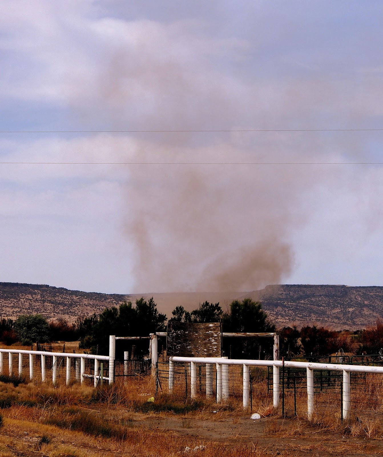
The views earlier were pretty, but it was really hard to tell how steep the terrain is through the area. This might give you a better idea on the ups and downs we were dealing with.
 |
| That's the washboard gravel road leading to Abiquiu |
ABIQUIU
About an hour after I had arrived in Abiquiiu, I get a tap on the shoulder. It was a sweaty Cjell. It's only day two or three for him, and he's already caught up to me. He's been going about 175 miles a day, but he looks fairly fresh, and sharing his gentle, perma-Cjell smile. The first thing he says to me is, "Few people will understand what you just did." I'm so glad I have someone to share it with. Cjell enjoyed a sandwich, a coffee malt and some conversation, and then hit the road again.
We stayed at the Old Abiquiu B&B, which is advertised on the Adventure Cycling Association (ACA) maps. The owner's name is Wanda and she has a whole camping area set up next to the river for $15 per night, which includes a shower and wifi. It's nice and cozy and Wanda is very welcoming, but bring the bug spray because the mosquitoes are heavy during this time of year.
 |
| Wanda's cove at dusk, right on the river. |
We paid an extra $10 for whole wheat pancakes with berries and yogurt for breakfast.
 |
| Wanda offering Neva pancakes and honey. |
EL RITO
Just 15 miles up the road is El Rito. It's a steady 1000 foot elevation climb the whole way, but all paved. There are lots of fun geological formations to look at, but there aren't many trees. When we arrived in El Rito, we were looking for the college dorms that might offer lodging. We bumped into a tiny friend on the search.
 |
| He won't take up too much space in the trailer, right? |
We eventually found the right person to talk to at Northern New Mexico Community College, Hope. I don't think I ever saw her sit down. She attended to seeming all of the duties and was on top of things getting done in a timely manner, all while maintaining a lovely smile and a plethora of useful information. We decided to stay an extra day in the dorms for only $36.00 a night.
Shirley and David in the kitchen kept us well fed. At only around $5.00 per meal, and boasting the progress of funding for the first fully sustainable kitchen in a college in the U.S., we really felt at home in this nice community of 800 people.
 |
| Neva enjoying home made vegetarian manicotti, garden salad and peas. |
I was fully satisfied to be done with one of the hardest portions of my journey, and felt very grateful to be so welcomed by the people in El Rito. A fitting and perfect relaxation following a perfectly diverse and difficult ride.